US Data Index Labs
An index of public US Esri REST services. Searchable, mappable and queryable.
Users and agents search and query Esri REST services and get answers with a citation.
Included at no additional cost with KxAI seats while the US Data Index is in Labs.
How it works
Koordinates indexes public Esri services, capturing information about each service and its URL. Those records go into a searchable index.
Map viewer
Draw and style an indexed service on the map, alongside your own layers.
KxAI Map Analyst
Find layers and ask questions of them using AI chat.
MCP
Search the index and query datasets from Claude or ChatGPT using MCP.
Service reliability depends on the publisher of the Esri REST service.
Current coverage
- 1,562
- servers
- 468,939
- layers and tables
- 10.8 billion
- features
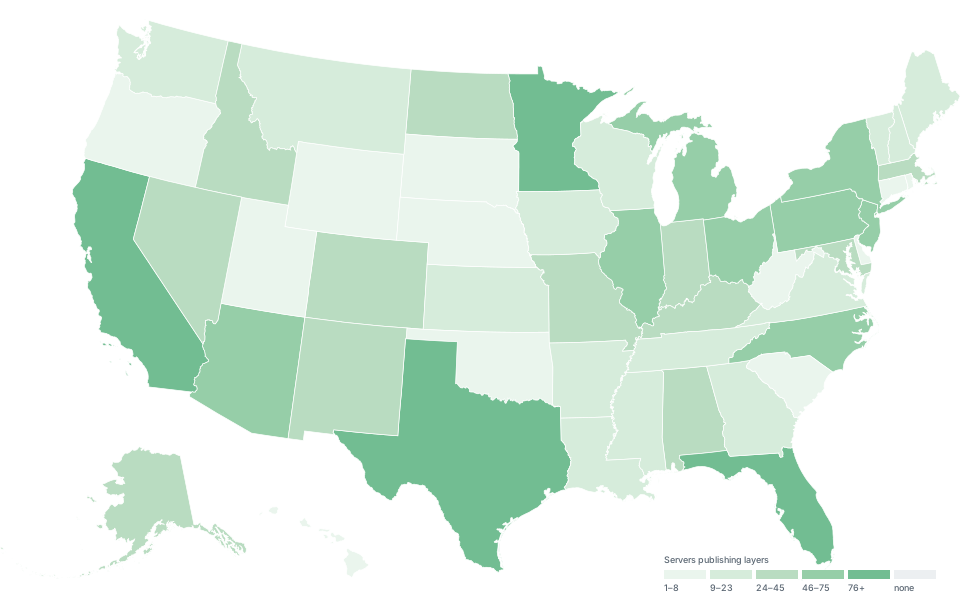
Shading is the number of servers per state. Figures as at 27 August 2026.
Data types available
Vector data only, published as Esri REST endpoints by US cities and towns, counties, state departments, regional bodies and MPOs, universities and federal agencies.
- Points Addresses, assets, sample sites
- Lines Roads, pipes, streams
- Polygons Parcels, zones, boundaries
Labs
The US Data Index is in Labs: an in-development catalog of data that we are enhancing as we go. It moves through three stages.
- Stage 1 Current stage
Labs
An in-development catalog, enhanced as we go. Free in the meantime.
- Stage 2
Beta
Key functionality identified from early user feedback is available, and subscription fees announced.
- Stage 3
Launch
Dataset index at high coverage, and available under all plans with a clear fee structure.